En 2009, Andy Matthews, cofondateur d'iFlightPlanner et directeur du développement commercial, travaillait à l'obtention de sa licence de pilote. Le jour d'un vol d'entraînement avec son père et un instructeur, le décollage d'Andy a été retardé par un contrôle au sol de la FAA. L'expérience est frustrante. Andy et son père ont passé plus d'une heure à préparer le vol la veille au soir, mais ils n'avaient pas de moyen efficace de montrer leur travail. L'idée de créer un meilleur outil de planification de vol pour les pilotes est née.
Andy s'est tourné vers son ancien colocataire de l'université du Michigan, John Burnside, un développeur web expérimenté. Tous deux ont fondé iFlightPlanner et lancé son site web en 2010. Une application iOS a suivi peu après.

Services de météorologie aéronautique et trajectoires de vol
L'application et le site web offrent une solution unique à utiliser avant, pendant et après un vol. Les utilisateurs peuvent planifier des itinéraires de vol à l'aide de cartes aéronautiques, accéder aux services de météorologie aéronautique, fermer des plans de vol FAA, obtenir des informations sur les aéroports et les installations, et bien plus encore.
John et Andy savaient que les services de météorologie aéronautique et les données météorologiques qui en découlent constitueraient un aspect essentiel de la qualité des produits iFlightPlanner.
"C'est l'une des premières choses que nous avons étudiées. Où obtenons-nous les données météorologiques ? Non seulement des données brutes que nous pourrions utiliser en coulisses pour les calculs, mais aussi des données visuelles", se souvient John.
Nouvelle application, nouveaux objectifs
Lorsque la société a lancé une nouvelle application, John et Andy voulaient qu'elle affiche des images météorologiques correspondant à celles disponibles sur la plateforme web - ce que leur fournisseur de services météorologiques ne pouvait pas fournir. iFlightPlanner a cherché une société avec un catalogue complet de produits, qui permettrait d'afficher les mêmes images météorologiques sur les plateformes web et mobiles et offrirait la flexibilité nécessaire pour créer un ensemble de services personnalisés. Baron était le fournisseur qui offrait des services de météorologie aéronautique de qualité et qui répondait à tous les critères.
"Nous avions besoin d'un modèle de tarification qui soit abordable mais qui nous permette de nous adapter à notre croissance. Baron était tout à fait disposé à nous aider à mettre au point quelque chose dans ce sens. Le fait de disposer de produits de haute qualité et d'un niveau d'assistance personnel a été déterminant. Ils ont travaillé avec nous pour créer un package qui soit adapté à notre activité, au lieu d'un modèle de tarification unique".
-- John Burnside, cofondateur d'iFlightPlanner

Le travail d'équipe fait fonctionner le rêve
iFlightPlanner et Baron ont mis au point des logiciels qui répondent au mieux aux besoins des aviateurs. Les produits intégrés dans leurs logiciels sont les suivants :
- Satellite visible à haute résolution
- Satellite infrarouge à haute résolution
- Vents et températures en altitude
- Cartes météorologiques significatives
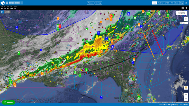
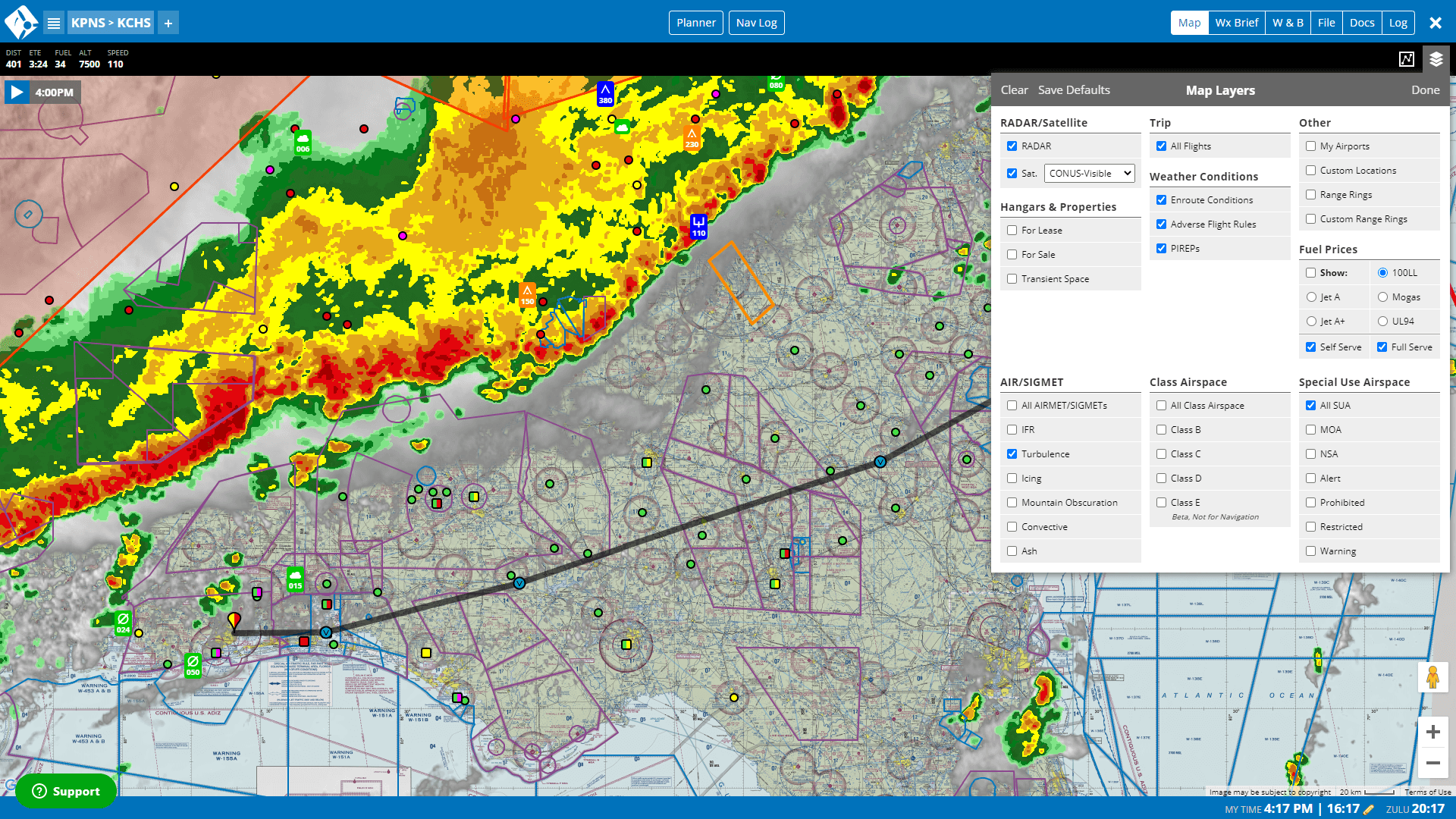
Les données météorologiques de Baron peuvent être affichées sous forme de couche cartographique sur les plateformes iFlightPlanner, ce qui permet aux pilotes de visualiser les conditions météorologiques qu'ils rencontreront au cours d'un vol.
"Si nous pouvons donner au pilote une image claire de ce à quoi va ressembler son vol et des conditions prévues, cela renforce sa confiance dans la sécurité des opérations de vol", a déclaré Andy. "Ce que nous affichons et ce que Baron met à disposition, c'est l'image composite (radar) au lieu de l'image de base (radar). Vous perdez en visibilité (des conditions météorologiques) si vous n'utilisez pas l'image composite. Il est toujours très utile d'avoir une image complète et de ne rien laisser au hasard.
Les produits Baron répondent aux exigences spécifiques d'affichage des plateformes web et mobiles d'iFlightPlanner. Au fur et à mesure que la société se développe, elle continuera à s'appuyer sur Baron pour fournir tous les services de météorologie aéronautique nécessaires pour répondre aux demandes des clients.
"Nous sommes bons dans ce que nous faisons du point de vue de la technologie et de l'aviation, et Baron est le meilleur en ce qui concerne la création de ces produits météorologiques", a déclaré Andy. "Nous ne nous lancerons jamais dans la création de produits météorologiques, c'est pourquoi un tel partenariat est fantastique.
